Impacts From Hurricane Irma Will Be Far Reaching
by Chris Kerr, on Sep 8, 2017 4:31:21 PM
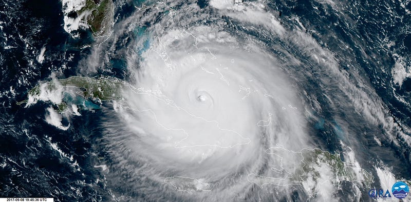
Irma remains a significant Category 4 hurricane late this afternoon with sustained winds around 155 mph. The sheer size of Irma is quite menacing, and spatially the hurricane covers an area roughly the size of Texas. Given this, sustained tropical storm force winds (in excess of 39 mph) will encompass the majority of the Florida peninsula over the coming days. The sustained hurricane force winds (in excess of 74 mph) will extend outward as much as 80 miles from the center! Note that hurricane force gusts could occur at locations over 120 miles from the center.

GOES-16 visible satellite image of Hurricane Irma on the afternoon of September 8, 2017. Image courtesy of CIRA/RAMBB
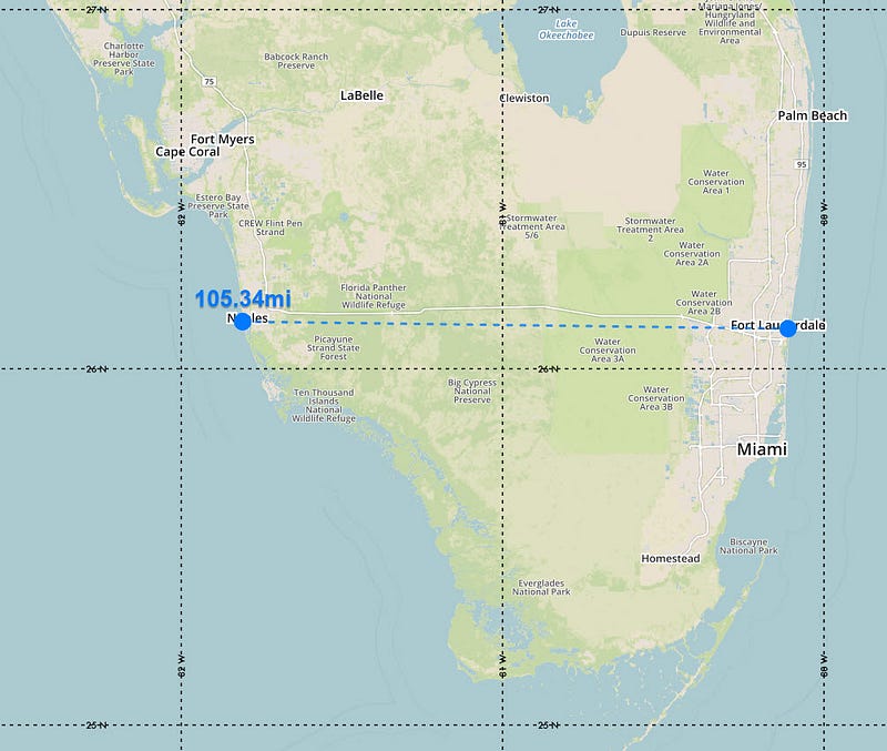
This is all stunning when you consider that the width of the southern part of Florida from Naples eastward to Ft. Lauderdale is roughly 100 miles. Catastrophic wind damage is likely to occur across much of south Florida this weekend. While Irma will gradually decrease intensity wise by late Sunday into Monday, significant impacts are still expected across the remainder of Florida and into parts of the Southeast US into next week.

Tropical Storm force winds will cover a majority of Florida this weekend
In addition to the winds, significant storm surge will be possible along both coasts of Florida. While a wide swath of heavy rainfall will occur over Florida, extreme/record setting rainfall is not expected due to the relatively fast forward speed.

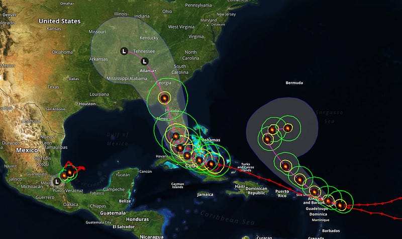
Latest tracks of Hurricanes Katia, Irma, and Jose (from left to right)
After Irma dissipates, attention then turns to Hurricane Jose and it’s future track. The latest model guidance suggests that Jose may linger in the southwestern Atlantic well into next week.


