by WeatherOps, on Jun 16, 2014 4:20:34 PM
Severe thunderstorms are possible Tuesday for portions of South Dakota and the Upper Midwest, as well as portions of Northwestern Texas and Western Oklahoma.
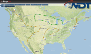
Low pressure will deepen over the Northern Rockies on Tuesday while the continued presence of high pressure is expected over the Southeast. Stronger flow aloft will be confined to the northern states where a lingering frontal boundary will likely provide the focus for severe weather. Scattered showers and thunderstorms, some severe, will be possible from Montana into the Great Lakes region. Highest potential for severe impacts will once again exist across the Upper Midwest region where moderate to extreme instability will develop by mid-afternoon. Another complex of thunderstorms looks most likely to develop across southern Minnesota, which will progress to the south and east through the evening and possibly the overnight hours. Large hail and damaging winds will be the primary hazards.
Further south, more isolated severe thunderstorms will be possible from Northwest Texas into west-central Oklahoma by late afternoon/early evening. Isolated severe hail and winds will be possible with any storm development.
SPC Convective Outlook for Tuesday