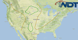
Scattered severe thunderstorms are possible today for portions of the Northern Rockies and Plains, as well as along the New Mexico/Texas border. General thunderstorms are possible for portions of the Gulf Coast and Northeast.
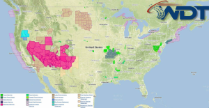
Current NWS Advisories/Watches/Warnings in iMapPro:
An area of low pressure and a strong upper level trough, in addition to low level moisture, will allow for the development of thunderstorms across portions of the Northern Plains. These storms will begin as individual supercells with the potential for large hail, damaging winds, and tornadoes. These storms will form a linear system that will move across the Dakotas overnight. Thunderstorms will also be possible along a front on the New Mexico and Texas border. Thunderstorms will develop in the higher terrain of New Mexico before moving eastward into Texas. These storms will have the potential for large hail and damaging winds.