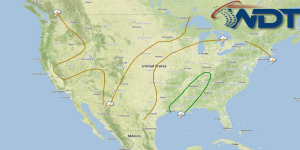
Scattered thunderstorms will develop from portions of Eastern Texas through Kentucky on Tuesday. A front will extend from Texas into Kentucky. While ongoing convection and cloud cover will limit severe potential, there should be sufficient instability for thunderstorms capable of large hail and damaging winds. In addition, flooding will be possible for portions of Louisiana and Mississippi with 2-3 inches of new rain possible.