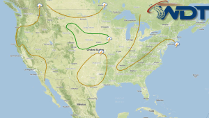
Strong to severe thunderstorms will be possible today for portions of the Upper Great Lakes, Mississippi Valley, and Plains. Showers and general thunderstorms will be possible for the Gulf Coast. Southeast, and East Coast. Across the Central Rockies, moderate snow will be possible with heavy snow in the higher elevations.
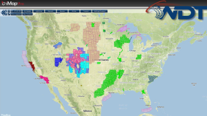
Current NWS Advisories/Watches/Warnings in iMapPro:
A cold front progressing through the Plains will allow for some severe thunderstorms from the Upper Great Lakes and southwestward into the Mississippi River Valley and Southern Plains. Large hail and damaging winds will be the main concerns, however, a few tornadoes will also be possible. Recent heavy rain and continues rain will allow for a flash flooding threat across the Southeast.
Additional moderate to heavy snow will be possible across the Central Rockies where accumulations will range from 4 to 8 inches.