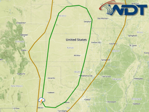
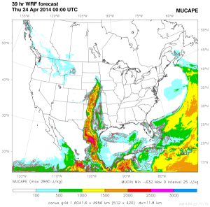
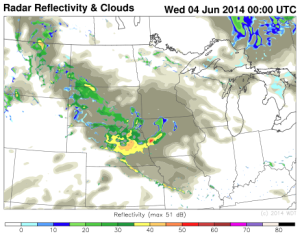
An upper level trough moving across portions of the Rockies will bring a chance for severe thunderstorms to portions of the Central High Plains on Wednesday. Daytime heating and moisture advection will help contribute to destabilization in the region. As the trough approaches the Plains, shear will increase, enhancing the potential for supercellular thunderstorms capable of large hail, damaging winds, and possibly some tornadoes. Later in the evening, a low level jet will strengthen over the Plains. As this occurs, ongoing storms will evolve into a squall line, posing a damaging wind threat.