Showers, and possibly some thunderstorms, will be possible today for portions of the Central and Southern Plains. A few severe thunderstorms will be possible across the Gulf Coast. Showers and thunderstorms will be possible for the Great Basin and Intermountain West.
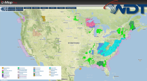
Current NWS Advisories/Watches/Warnings in iMapPro
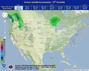
A frontal boundary tracking southeastward across the Southern Plains will generate a few showers and thunderstorms across the region. An area of low pressure lifting through the Central Gulf of Mexico will promote widespread activity through the Panhandle of Florida. Scattered showers and thunderstorms will be possible for portions of the Great Basin and Intermountain West. While severe thunderstorms are not expected, heavy rain and small hail will be possible. An area of low pressure currently moving over the Upper Midwest and Great Lakes will allow for light to moderate snowfall.
WDT preferred forecast for 24 hour snowfall accumulation through 7AM CDT Friday