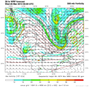
A system developing over the Gulf of Mexico will become the focal point for an intense winter storm across the Northeast on Wednesday. This system will move across the Florida peninsula today and bring thunderstorms to portions of Central Florida. After it crosses into the Atlantic, it will move northward along the East Coast. As it remains over water, it will rapidly intensify and bring heavy snow and strong winds to portions of the Northeast with the heaviest snow over portions of Maine and Newfoundland.
WDT WRF 500 mb vorticity 8pm EDT Tuesday
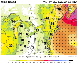
Strong winds and heavy snow will be possible. In some places, conditions will approach blizzard criteria. A Blizzard Watch is in effect for the capes of Massachusetts where snow of 6 inches or more will be possible. In addition, sustained winds to 40 miles per hour with gusts to 60 mph will be possible. Power outages will also be possible.
WDT WRF winds 8pm EDT Wednesday
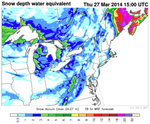
Up to 2 feet of snow will be possible in portions of Newfoundland.