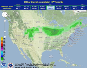
A cold front and area of low pressure will move through the Central and Southern Plains on Tuesday with a large swath of precipitation from the Central Rockies through the Great Lakes and into the Gulf Coast. 2-6 inches of snow is possible from portions of the Rockies through the Great Lakes and points south into the Gulf Coast. Gusty winds will allow for limited visibilities and high snow drifts, but strong winter storm conditions are currently not anticipated.
Thunderstorms will be possible for portions of the Midwest and Gulf Coast. No severe weather is expected, but some heavy rain, lightning, and high wind gusts are possible.
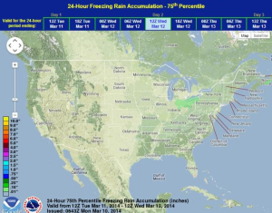
WDT preferred forecast for snow and ice accumulation through 6AM Wednesday