by WeatherOps, on Feb 21, 2014 9:32:08 AM
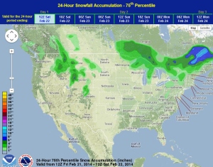
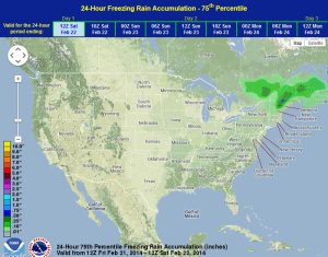
Severe weather will be possible into the early evening for portions of the Mid Atlantic and Southeast. Light freezing rain and moderate to heavy snow will be possible for portions of Northern New England into Maine. For the Upper Midwest and Great Lakes, moderate to heavy snowfall will continue through the morning and early afternoon. Light to moderate snowfall will continue for portions of the Intermountain West and Rockies.
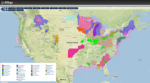
Current NWS Advisories/Watches/Warnings from iMapPro
An intense area of low pressure centered near Lake Superior will continue to lift northeastward through the end of the day. A cold front currently extends from Upstate New York to the Gulf of Mexico. This front will be the focus for thunderstorms into the evening for portions of the Mid Atlantic and into the Gulf. Damaging winds will be the main concern, but a few isolated tornadoes will be possible. For portions of Northern New England into Maine, heavy snow will be possible with some light ice accumulations. Light to moderate snowfall will continue through the Intermountain West and Rockies.
WDT preferred model for 24 hour snow and ice accumulation through 6AM CST Saturday