Moderate to heavy snow will continue for portions of the Northwest as another low pressure system moves into the region. Snow will be possible for portions of the Northeast as an area of low pressure exits the region. Showers and thunderstorms will be possible tonight for portions of the Southeast as a shortwave trough moves across the region.
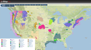
NWS Advisories/Watches/Warnings from iMapPro:
In addition to the moderate to heavy snowfall across the Northeast, precipitation will be in the form of rain for the Mid Atlantic region. In the west, rain and snow continues as another system moves onshore. Deep moisture streaming into the region will allow for heavy rainfall and snowfall throughout the day.
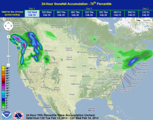
WDT preferred forecast for 24 hour snow accumulation through 6PM Tuesday
6-10 inches of snow will be possible for portions of New England, though other areas will see around 3-6 inches. In the Pacific Northwest, lower elevations could see over two inches of rainfall while higher elevations could pick up 12-20 inches of snow.
Thundersnow was reported in some areas yesterday. In these areas, snowfall rates were as high as one inch per hour. Snow that fell across the Great Lakes caused more than 1,000 flights to be cancelled and several automobile crashes were reported in the Grand Rapids and Muskegon, Michigan areas.