There won’t be much in the way of precipitation today, with the exception of portions of Texas and the Great Lakes. Ongoing lake effect snow over the Great Lakes will produce 2-5 inches of snow. The bigger story, however, will be the wind chill across much of the Plains.
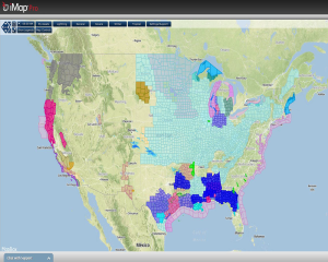
Current NWS Watches and Warnings:
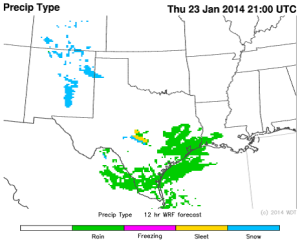
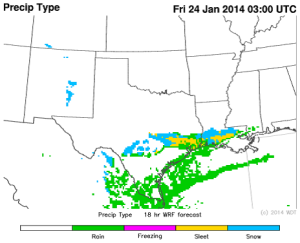
The Arctic air mass over the Plains will be dry so behind the front, little to no precipitation is expected. Ahead of the front, however, some light snow will be possible across Southwestern Kansas and the Oklahoma and Texas Panhandles. As the cold air continues to move south into Texas, lift and moisture will be sufficient for some precipitation across portions of Central and Southern Texas tonight and into Friday morning. As the colder air begins to move further south, sleet and freezing rain will be the main concern. Up to a tenth of an inch of ice and an inch of snow will be possible.
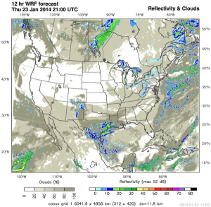
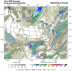
WDT WRF model Reflectivity for 3pm and 9pm CST Thursday:
WDT WRF model Precip Type for 3pm and 9pm CST:
Roads, especially bridges and overpasses, will start to become slick overnight tonight. Travel is expected to be difficult tonight and into tomorrow morning.