National Weather Summary for Monday, February 22, 2016
by David Moran, on Feb 22, 2016 10:38:50 AM
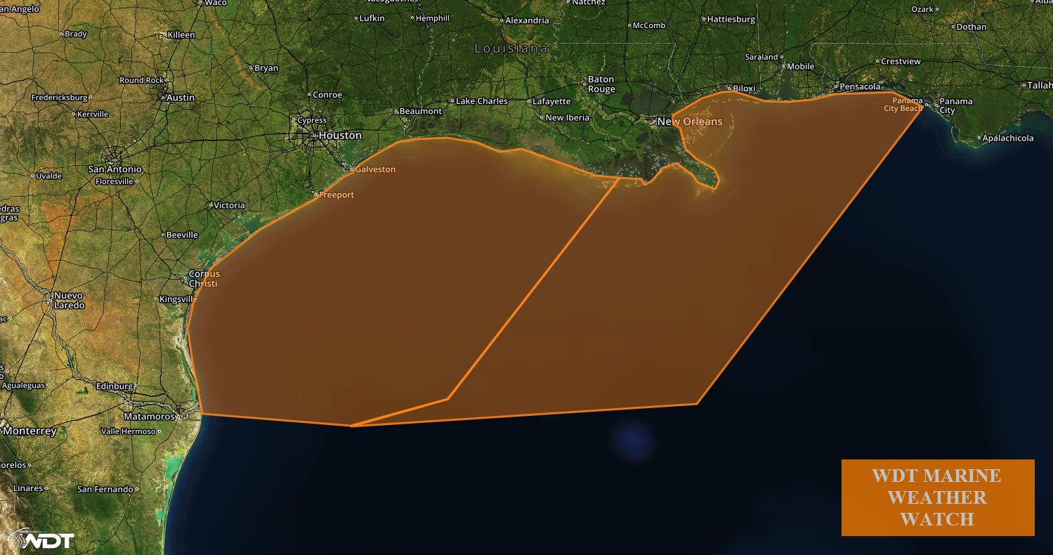
An area of low pressure moving through the Southern Plains and Ohio River Valley will bring snow from the Southern Plains and northeastward through the Great Lakes. Gale force winds and rough to very rough seas will be possible across portions of the Northern Gulf of Mexico as an area of low pressure deepens across west Texas.

US Hazards
Region 1
An area of low pressure moving through the southern states and northeastward through the Ohio River Valley will bring snow from the Plains through the Great Lakes from Tuesday through Thursday. Snowfall accumulations of 1-3 inches will be possible through midday Wednesday. As the low continues to move northeastward, several inches of snow will be possible from Missouri through the Lower Peninsula of Michigan through mid-morning Thursday.

Region 1
Region 2
The same area of low pressure mentioned above will increase southerly winds across the northern Gulf of Mexico to 20-30 knots beginning early Tuesday afternoon. As the low moves eastward, winds will become northwesterly at 30-35 knots. The wind shift will begin on the Texas Gulf Coast early Tuesdat evening and will progress rapidly to the east, reaching the eastern boundary of the watch area around midnight.

Region 2


