Do You Know What Causes Fire Weather?
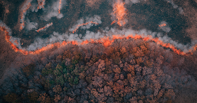
It’s windy outside, the air is dry, and so is the vegetation; these are variables that often lead to wildfires. However, there are more ingredients than just these that cause fires. Fire weather is a combination of conditions that set the stage for the rapid spread of wildfires.
The critical weather conditions that determine fire weather risk are:
1. Maximum Temperature
Building materials and vegetation ignite faster and burn longer in warmer environments. Therefore, fire weather risks are higher during the afternoon when the air temperature is above 50°F.
2. Minimum Relative Humidity
Relative humidity is a measure of how close air is to saturation. A low relative humidity causes fires to burn more vigorously since any available moisture evaporates. Relative humidity is at a minimum during the afternoon when the air temperature is highest. The Storm Prediction Center (SPC) defines regional relative humidity thresholds for fire weather based on local climatology. Maritime climates, including Florida, have somewhat higher limits.
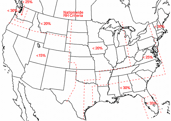
SPC Regional Relative Humidity Thresholds for Fire Weather
3. Mixing Height
The mixing height is the height at which a plume of smoke will stop rising. A cumulus cloud base is a good indicator of the mixing height. Mixing height is critical for managing the dispersion of smoke from wildfires and becomes unfavorable when the mixing height lowers during the early morning and evening hours. When temperatures increase with height above the surface, such as on a calm, clear night or from warm advection, the mixing height becomes zero. Fire is more manageable in this stable environment, but extremely poor air quality can result from existing smoke becoming trapped near the surface.
4. Wind Speed & Direction
Strong sustained winds (> 20 mph) carry oxygen and push flames toward adjacent fuel, acting to “preheat” the surrounding environment for ignition. Wind shifts from a passing cold front and turbulent eddies near buildings, unique terrain, and tree lines may cause erratic fire behavior and steer existing fires in different directions.
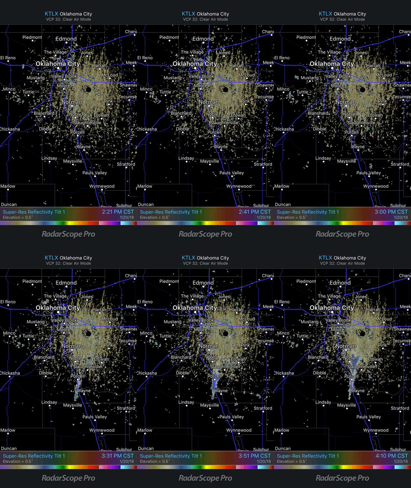
Horizontal smoke dispersion is forecast using knowledge of the transport wind. The transport wind is the average wind between the surface and the mixing height. For example, the transport wind on January 20, 2018, in Central Oklahoma was southerly at around 20 mph. This is well illustrated by the northward movement of the smoke plume from west of Wayne, OK toward southeast Norman, OK, as shown in the below RadarScope animation.
The SPC provides Fire Weather Outlooks to outline fire risks during the next eight days. A Critical fire risk area is forecast when temperatures are above 50-60°F, regional relative humidity thresholds are met, and sustained winds are 20 mph or higher (15 mph in Florida) for at least three consecutive hours. A fire weather outlook also includes Elevated fire areas, when weather conditions are approaching Critical thresholds, and there is more forecast uncertainty. An Extreme fire area is reserved for severe cases that deviate significantly from regional climatology. The Thomas Fire in southern California occurred in an Extreme fire risk.

For the central Plains, fire weather conditions most frequently develop to the west of well defined dry lines or in the wake of cold fronts. These boundaries separate moist and dry air masses and their movement results in sharp drops in humidity and strong winds typically during late winter and spring. The National Weather Service (NWS) issues a variety of alerts when these weather conditions are critical to fire management. A Fire Weather Watch is issued when Critical fire weather is expected within 72 hours. This alert is upgraded to a Red Flag Warning when fire weather conditions become imminent.




 Comprehensive weather insights help safeguard your operations and drive confident decisions to make everyday mining operations as safe and efficient as possible.
 Learn how to optimize operations with credible weather and environmental intelligence. From aviation safety to environmental compliance, our comprehensive suite of solutions delivers real-time insights, advanced forecasting, and precise monitoring capabilities.