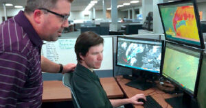
Do You Know How to Read a Weather Map?
Have you ever looked at a weather map and wondered what all the symbols mean? Most people understand what a cold or warm front looks like and have seen the large L or H for low and high pressure. Many haven’t seen a real surface weather map and might be confused if they did.
When you’re learning to become a meteorologist you take a lot of math classes and I do mean a lot. You also take a large variety of meteorology classes. You learn very early on how to analyze a weather map and it’s a bit more complicated than tossing fronts on a map. You have to first find the frontal area and low and high pressure area in detail.
Below is a surface weather map showing part of the U.S. This is what it looks like before is has been analyzed. Do you know what those symbols mean? Let’s go over the basics.
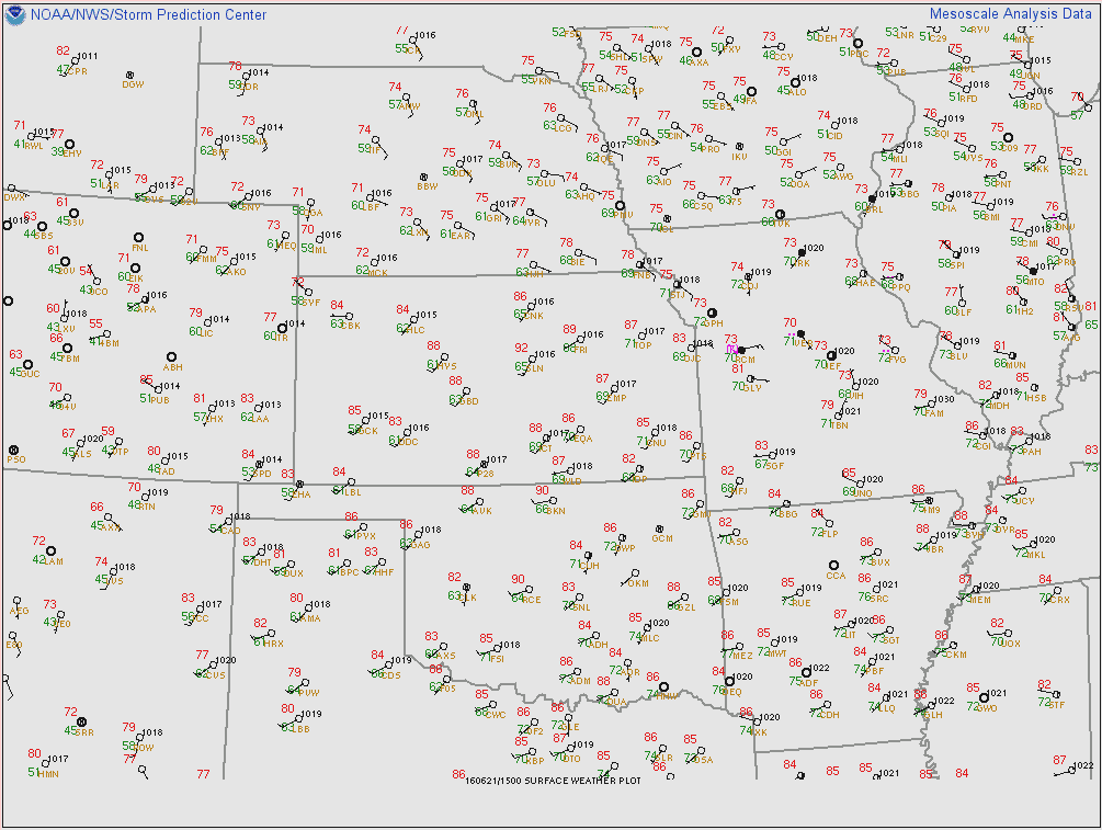
First off, let’s figure out what the letters are telling us. Those are three letter station identifiers, just like airports use. Every place that has an official weather station has a special identifier. Meteorologist learn these quickly. For instance, in southwest Kansas you can find one labeled DDC. This stands for Dodge City. If you look around, some are a little tougher to figure out. Check here for a full listing.
Next let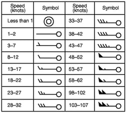 ‘s talk about how to figure out the wind. The little circle with a line sticking out gives us that information. Those are called wind barbs and the direction they point is the direction the wind is blowing from. For instance, a south wind would have the staff coming straight out of the bottom of the circle. The lines on the staff are called flags and they tell us how fast the wind is blowing. Many times the measurements are in knots. Multiple the knots by 1.151, if you want to convert them to miles per hour You can check out the chart on the left to learn what speeds the different flags mean.
You may have also noticed that the circle the wind barb comes out of isn’t always clear. It tells us what the cloud cover is outside. As expected, a clear circle means there are no clouds. The circle is usually colored in by quarters. When the circle is completely colored in, the sky is overcast.
Some of the stations have a four digit number in the top left, this tells us the barometric pressure. On some maps, you may see a three digit number. For instance, if you saw a map and the number in that corner was 296, the pressure would be 1029.6 millibars. By connecting similar pressures, you can find where any high or lows are located.
This map also shows us the temperature and dew point, measured in Fahrenheit. The red number is temperature and the green number is the dew point. Many times meteorologist will say it is 94 over 73 outside, which can sound confusing if you haven’t seen a weather map. They are just referring to how it is plotted, so that would mean the temperature is 94ºF and the dew point is 73ºF.
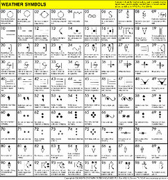 We also can plot many different kinds of weather conditions on a surface map. Rain, snow, thunderstorms, tornadoes and many more conditions have their own special symbols. Using symbols is a way to convey a lot of information in an easy to read format. The number of the symbols can even tell how much rain or snow is falling. So, a dot stands for rain, three dots in a triangle shape tell us the rain is moderate and continuous, and 4 dots in a diamond shape means the rain is heavy and continuous. Before the internet, seeing the tornado symbol on a weather map was the main way we knew that a tornado was affecting a certain part of the country. Click on the chart on the left to enlarge it and see the symbols in more details.
Next time you see a surface weather map with stations plotted, this information will hopefully give you a better idea as to what you are looking at and what it going on outside. As you can see, there is a lot more to it than warm and cold fronts.



 Comprehensive weather insights help safeguard your operations and drive confident decisions to make everyday mining operations as safe and efficient as possible.
 Learn how to optimize operations with credible weather and environmental intelligence. From aviation safety to environmental compliance, our comprehensive suite of solutions delivers real-time insights, advanced forecasting, and precise monitoring capabilities.