by WeatherOps, on May 13, 2014 2:01:20 PM
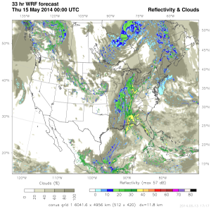
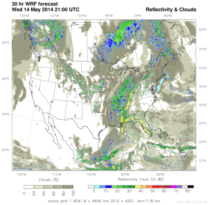
An upper level trough moving across the Plains will bring a chance of severe thunderstorms to portions of the Ohio River Valley and Southeast on Wednesday. At the surface, a cold front will move east. Ahead of the front, moisture will continue to move northward. This moisture and daytime heating will provide sufficient destabilization for the development of thunderstorms. Strong shear will allow for the potential for large hail, damaging winds, and tornadoes.
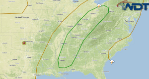
SPC Convective Outlook
WDT WRF Simulated Radar 5pm & 8pm EDT Wednesday