Showers and thunderstorms, some severe, are possible for portions of Florida today. Isolated showers and thunderstorms are possible over the Western US. Across the Upper Midwest, moderate snow and light icing is possible overnight.
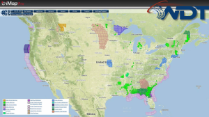
Current NWS Advisories/Watches/Warnings in iMapPro:
Showers and thunderstorms are ongoing across portions of the eastern Gulf of Mexico into the Florida Panhandle and parts of Alabama and Georgia as an area of low pressure moves northeastward through the region. There is a slight risk for severe thunderstorms for portions of the Florida Panhandle. A few severe thunderstorms will be possible, but the main threats will be very heavy rainfall and flooding.
An upper level trough tracking through the Desert Southwest will aid in the development of thunderstorms across the Western US. Light snow will be possible for the Intermountain West. Another area of low pressure will be possible for portions of Northeastern Minnesota.
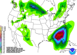
WDT preferred forecast for rainfall accumulation through 7AM CDT Saturday