by WeatherOps, on Apr 14, 2014 9:47:43 AM
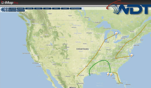
Isolated severe thunderstorms are possible today for portions of the Arklatex region, Lower Mississippi River Valley, and the Gulf Coast. A rain and snow mix is likely for portions of the Central Plains. Showers and thunderstorms are possible for portions of the Interior Northeast and Ohio River Valley.
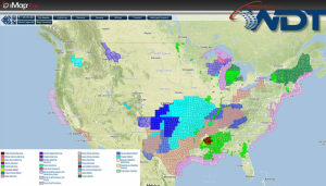
Current NWS Advisories/Watches/Warnings in iMapPro
A rain/snow mix is possible today for portions of the Texas Panhandle through northeast Kansas and Northwestern Missouri as an area of low pressure moves across the region. Further east and southeast, showers and thunderstorms are possible from Louisiana into the Ohio River Valley. The best chance for severe thunderstorms will be from Louisiana to the Florida Panhandle. Small hail, damaging winds, and an isolated tornado will be possible.
Convective Outlook for Monday