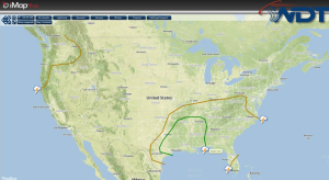
Rain and thunderstorms will be possible for portions of the Southeast on Friday. There is a slight risk for severe weather from Eastern Texas into the Lower Mississippi River Valley. Low elevation rain and mountain snow will be possible for the Pacific Northwest, in addition to some thunderstorms.
An area of low pressure will continue to move across the Great Lakes and St. Lawrence Valley. Any snow or ice will move east with it, though most of the snow should remain north of the border. Any icing will likely be across New England and will be under a tenth of an inch. The cold front associated with this area of low pressure will move across the Southeast and Ohio River Valley. Ahead of the front, a slight risk of severe weather exists for portions of Texas, across the lower Mississippi River Valley, and into portions of Mississippi and Tennessee. Thunderstorms will also be possible for the Northern and Central Gulf of Mexico. Some of this activity may be strong to severe.