by WeatherOps, on Feb 28, 2014 3:02:07 PM
Severe thunderstorms have developed across Central California ahead of an area of low pressure. This is a recent radar image.
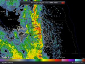
Quarter sized hail and damaging wind gusts to 70 mph will be possible. In addition, there may be some locally heavy rain.
WDT WRF Simulated Radar 4pm PST