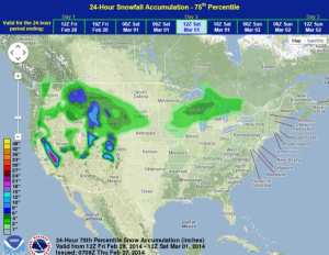
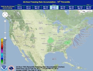
Showers and thunderstorms will continue for the lower elevations of California and into the Rockies with moderate to heavy snow for the higher elevations. Light to moderate snow will also continue for portions of the Great Lakes and Midwest.
An area of low pressure will move across the Rockies and into the Northern Plains, allowing for rain and thunderstorms on Friday. As this system continues to move across the Plains and a cold front moves southward, some light snow will be possible for portions of the Great Lakes. Wind Chill Advisories and Warnings will be likely for portions of the Northern Plains, Midwest, and Great Lakes. Another stronger area of low pressure will move into California late Friday allowing for heavy rain and snow. A shortwave moving through the Tennessee Valley will allow for thunderstorms, but no severe weather is expected.
WDT Preferred Forecast for snow and ice accumulation through 6am CST Saturday