by WeatherOps, on Feb 19, 2014 4:12:54 PM
Severe thunderstorms are possible for portions of the Southern Great Lakes and points south toward the Gulf Coast and Mid South. For the Upper Midwest and Mississippi River Valley, blizzard conditions will be possible. Lower elevation rain and higher elevation snow will continue for portions of the Pacific Northwest.
Low pressure will rapidly intensify as it moves through the Plains. As it continues to track ito the Ohio River Valley, thunderstorms will be possible. Damaging winds will be the main concern, but some isolated tornadoes will be possible from Tennessee into the Ohio River Valley. Blizzard conditions will be possible for portions of Iowa and Wisconsin with wind gusts to 50 miles per hour and 6-12 inches of snow possible.
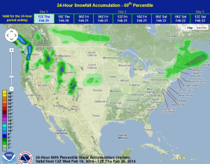
WDT preferred forecast for 24 hour SNOW accumulation through 6:00 PM Thursday
SPC Convective Outlook for Thursday
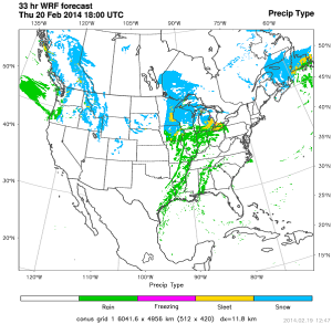
WDT WRF Precip Type valid 12 PM CST Thursday, February 20, 2014:
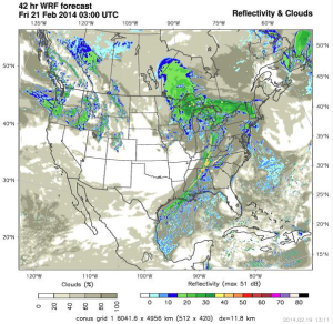
WDT WRF model simulated Radar valid 9 PM CST Thursday, February 20, 2014: