by WeatherOps, on Feb 18, 2014 12:30:32 PM
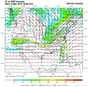
Severe thunderstorms are possible for portions of the Upper Mississippi River Valley and the Ohio River Valley ahead of an upper level trough that will dig across the Northern Plains. This is the SPC outlook for Thursday and a 500 mb vorticity map for 12pm Thursday from the WDT WRF model.
SPC Day 3 Convective Outlook
500 mb Vorticity 12pm CST Thursday
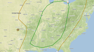
Ahead of the trough, moisture will begin to move northward. Daytime heating and low level moisture will contribute to destabilization. This destabilization, in addition to the forcing from the trough will be sufficient for thunderstorm development. Thunderstorms will begin to develop in the Upper Mississippi River Valley and then develop southward into the Lower Mississippi River Valley. Any thunderstorms that develop will develop into a squall line with damaging winds being the main threat, however, embedded tornadoes will also be possible.
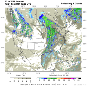
WDT WRF Simulated Radar Thursday 6pm CST