Light to moderate snow is expected today from portions of the Southern Appalachians and into the Carolinas. Light to moderate icing is also expected through East Texas into the Carolinas. In the Northern Plains, a clipper system will bring light to moderate snow to portions of the Northern Plains and the Midwest. For the west, rain and snow will continue through the Cascades and the Coastal Range with rain in the lower elevations.
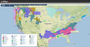
Current NWS Advisories/Watches/Warnings in iMapPro
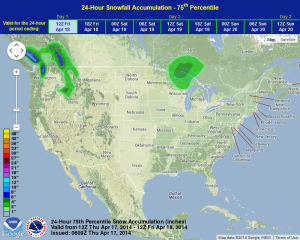
An area of low pressure will continue to move into British Columbia and the Pacific Northwest. Two day snowfall totals could be as high as two feet in some places, especially in portions of the Cascades and the Coastal Range of British Columbia. Another round of rain and snow will continue for portions of the Coastal Range and Cascades tonight.
In the Northern Plains, a strengthening frontal boundary will intensify across Southern Alberta and Saskatchewan later today into tomorrow. Snow will begin to develop from portions of North Dakota and into Michigan.
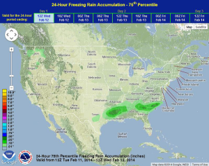
In the Southeast, freezing rain, sleet, and snow will continue into Wednesday as the area of low pressure currently affecting this area continues to intensify. As this area of low pressure continues to intensify, light to moderate snow will be possible from portions of Southeastern Tennessee and into North Carolina with accumulations of 1-3 inches possible. Light to moderate icing will be possible from portions of Mississippi through South Carolina with a tenth to a quarter inch of ice will be possible. Heavier icing will be possible for portions of Louisiana, as well as portions of Georgia and South Carolina, where up to half an inch of ice is possible.
WDT preferred model for 24 hour snow and ice accumulation through 6am CST Wednesday