by WeatherOps, on Feb 6, 2014 12:37:52 PM
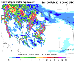
A large storm system will bring up to two feet of snow to portions of the Rockies through Saturday.
Infrared Satellite
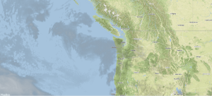
This system will come onshore later today and move into the Rockies. Ahead of this system, heavy snow will be likely for portions of the Sierra Nevada and into the Rockies.
WDT WRF model Simulated Radar Loop
[video width="512" height="288" wmv="http://wdtinc.com/wp-content/uploads/2014/02/snowacc.wmv"][/video]
The heaviest snow will be across the Rockies where up to two feet of snow is possible for portions of Colorado, in addition to wind gusts to 25 miles per hour, as well as snow packed and icy roads will also be possible.
WDT WRF Snow Accumulation through 5pm MST Saturday
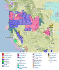
Current NWS Watches/Warnings/Advisories