by WeatherOps, on Jan 24, 2014 1:52:38 PM
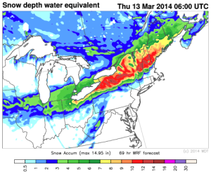
Snow will be likely for portions of the Ohio River Valley and the Northeast extending from Ohio to New York ahead of an upper level low over portions of Eastern Canada. The cold front associated with this system will move over the Great Lakes region through the weekend.
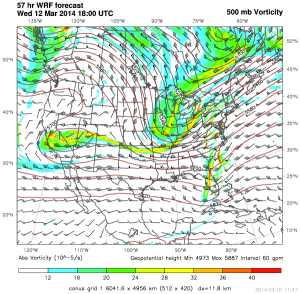
WDT WRF Model 500 mb vorticity 6am CST Saturday
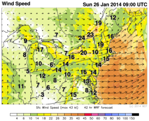
Our in house WRF model is forecasting over a foot of snow over the Great Lakes and Northeast through Monday morning. Winds will be strong at times with gusts over 20 miles per hour at times. Even though there will occasionally be some strong winds, blizzard criteria is not expected to be achieved.
WDT WRF simulated radar and winds at 4am EST Sunday
WDT WRF snowfall totals through 7am EST Monday